October 15, 2022 – Pine Bush, NY
Difficulty: Moderate
Length: Approximately 3.5 miles
Max elevation: 1,791 ft.– total elevation gain approximately 550 ft.
Route type: Circuit
Free map: Shawangunk Ridge State Forest Trail Map – 2021
Free map: Shawangunk Ridge Trail Map – 2016
Buy Map (Paper & Avenza): Shawangunk Trails Map 106B – 2019
Trailhead parking: Cox Road Parking Area – 336 Cox Rd, Pine Bush, NY 12566
Gravel parking lot for about 15 cars – No restrooms on site
Shawangunk Ridge State Forest is a Carry-in/Carry-out area
Overview:
The 1,411-acre Shawangunk Ridge State Forest is part of an interconnected and preserved corridor of land that stretches south from Ulster County, through Sullivan County and into Orange County, NY. It is part of the southern section of the Shawangunk Mountain range known as the Shawangunk Ridge.
Shawangunk Ridge State Forest as viewed from Bear Hill Nature Preserve – October 2016
Pronounced shuh-WAN-gunk, or SHON-gum by locals, “The Gunks” are known widely for their dramatic cliffs and landscapes, dwarf pine barren forests, “ice caves”, and classic rock climbing.

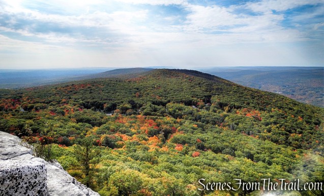
Bear Hill Nature Preserve as viewed from Shawangunk Ridge State Forest

Long Path/Shawangunk Ridge Trail – Shawangunk Ridge State Forest

Red Trail – Shawangunk Ridge State Forest
History:
In the year 2000, the Shawangunk Ridge State Forest was created through a partnership between New York State, Open Space Institute (OSI), Trust for Public Land (TPL) and others.
The Open Space Institute purchased several major parcels along the Shawangunk Ridge and transferred them to the New York State Department of Environmental Conservation (DEC) to be held and managed as state forests.
Subsequent acquisitions over the years have significantly expanded the chain of state forests, including the Shawangunk Ridge, Roosa Gap, Wurtsboro, and Huckleberry Ridge State Forests.
Trails Overview:
A 1.8-mile section of the co-aligned Shawangunk Ridge Trail and the Long Path passes through Shawangunk Ridge State Forest. To the south the trail continues on into Roosa Gap State Forest. To the north the trail continues onto private land and eventually onto Minnewaska State Park to the north of Route 52.
The 1.2-mile section of the co-aligned SRT and Long Path traversed on this hike, provide spectacular views of the surrounding valley, extending all the way to the Catskills.

Long Path/Shawangunk Ridge Trail – Shawangunk Ridge State Forest
Starting in 2015, the NY-NJ Trail Conference created 4 miles of new trails in Shawangunk Ridge State Forest, connecting the Long Path (and SRT) to parking areas, making loop hikes possible.
Hike Overview:
October is leaf peeping season and The Gunks are nothing short of spectacular during that time. That is probably the busiest time of the year in that area. The more well known spots like Minnewaska State Park, including the Sam’s Point Area and the Mohonk Preserve, can get extremely crowded during that time, especially on weekends. I decided to try a less popular section of the ridge, or so I thought. We arrived at the parking area on Cox Road at 10am on a Saturday morning and the 15-car gravel lot was nearly full. By the time that we finished the hike, the lot was jammed and there was a long line of vehicles parked along the side of Cox Road. My advice is to get there early or visit on a weekday. You should also back your vehicle into one of the parking spots, making it a lot easier to exit. You’ll be glad you did.
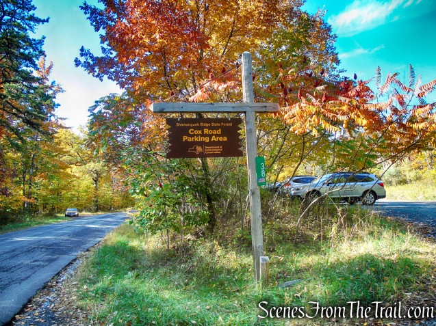
Cox Road Parking Area – Shawangunk Ridge State Forest
While researching this hike, I couldn’t find much information online and figured that this was a lesser trafficked area and possibly a hidden gem. Even though the small lot was nearly full when we arrived (10am), I was shocked at the end of our hike when I saw how jammed the parking lot was, making it difficult to back out and leave.
I would suggest doing this hike clockwise as most of the people we encountered were going in the opposite direction. By going clockwise, it’s a shorter distance to the ridge and after reaching the highpoint, you will have almost continuous views in front of you as you descend.
This moderate loop is one of the better hikes that I have done when it comes to the all-around hiking experience. It has views and extremely scenic landscape along the ridge and just below it. It has to be experienced to be truly appreciated.

Shawangunk Ridge State Forest Loop from Cox Road Trailhead

elevation profile – Shawangunk Ridge State Forest Loop
The Hike:
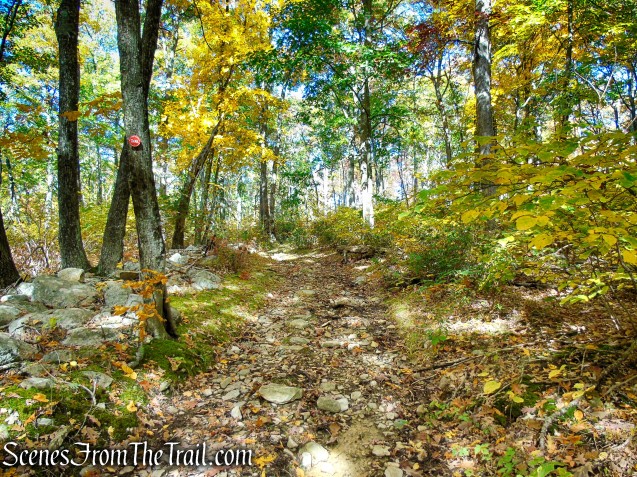
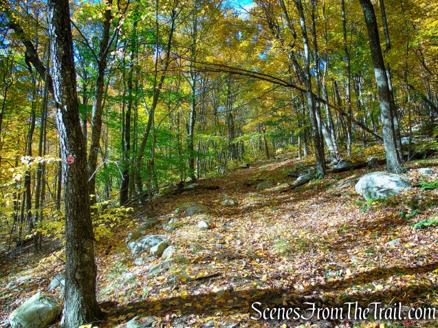
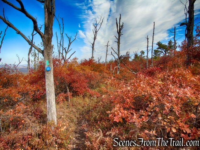
From the kiosk at the parking area, head uphill on the Red Trail, which follows a woods road. Almost immediately, a wooden post marks a branch of the trail that goes to the right. This will be your return route, but for now, continue ahead on the woods road, following the red blazes.

Cox Road Parking Area – Shawangunk Ridge State Forest

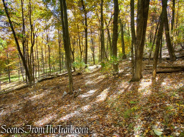
Red Trail – Shawangunk Ridge State Forest

Red Trail – Shawangunk Ridge State Forest

Red Trail – Shawangunk Ridge State Forest
Red Trail – Shawangunk Ridge State Forest
In 0.4 mile, you’ll cross a stream on large stepping stones. Soon, the Red Trail begins to climb more steeply and narrows to a footpath.

Red Trail – Shawangunk Ridge State Forest

Red Trail – Shawangunk Ridge State Forest
Red Trail – Shawangunk Ridge State Forest

Red Trail – Shawangunk Ridge State Forest

Red Trail – Shawangunk Ridge State Forest
Red Trail – Shawangunk Ridge State Forest
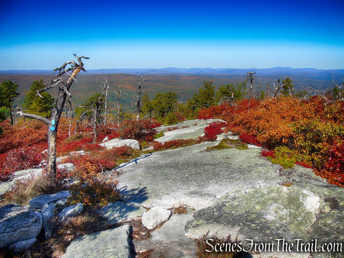
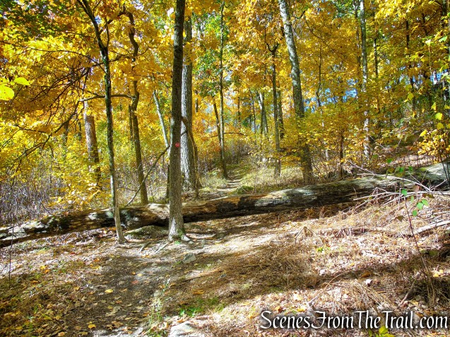
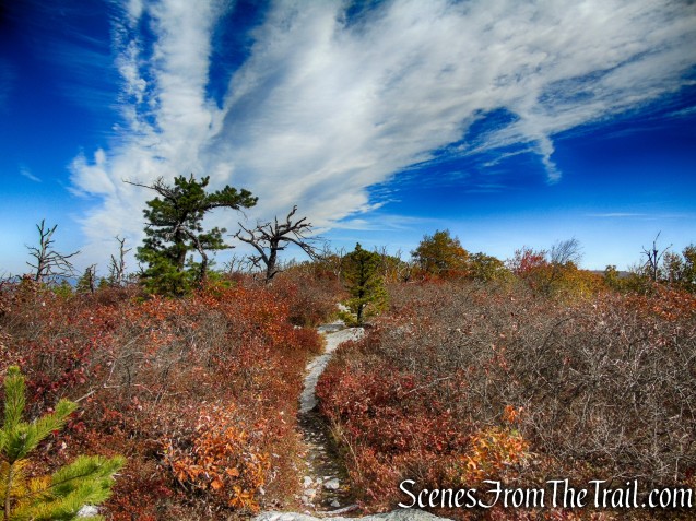
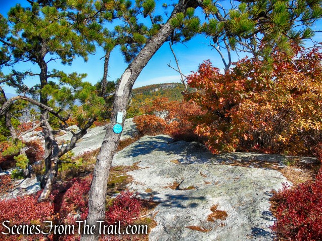
After passing cliffs on the right and going through an interesting passage between rocks, you’ll reach a junction with the Long Path/Shawangunk Ridge Trail at the crest of the ridge. Turn right onto the Long Path/Shawangunk Ridge Trail, which you’ll be following for the next 1.2 miles.

Red Trail – Shawangunk Ridge State Forest

Red Trail – Shawangunk Ridge State Forest

Red Trail – Shawangunk Ridge State Forest

Long Path/Shawangunk Ridge Trail – Shawangunk Ridge State Forest
Long Path/Shawangunk Ridge Trail – Shawangunk Ridge State Forest

Long Path/Shawangunk Ridge Trail – Shawangunk Ridge State Forest

Long Path/Shawangunk Ridge Trail – Shawangunk Ridge State Forest
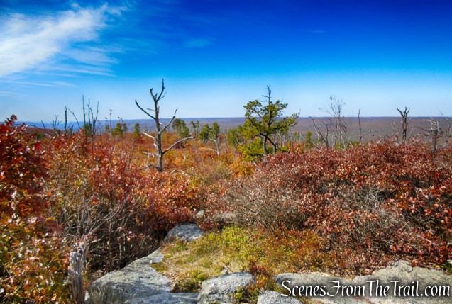
The ridge that you’re following was burned in a forest fire in May 2015. Low vegetation was destroyed in the fire, and many small trees were burned, but the trunks of larger trees remained unscathed. The vegetation has begun to regenerate, but many small dead trees scarred by the fire can still be seen.

Long Path/Shawangunk Ridge Trail – Shawangunk Ridge State Forest
Long Path/Shawangunk Ridge Trail – Shawangunk Ridge State Forest

Long Path/Shawangunk Ridge Trail – Shawangunk Ridge State Forest

Long Path/Shawangunk Ridge Trail – Shawangunk Ridge State Forest
Long Path/Shawangunk Ridge Trail – Shawangunk Ridge State Forest

Long Path/Shawangunk Ridge Trail – Shawangunk Ridge State Forest
Long Path/Shawangunk Ridge Trail – Shawangunk Ridge State Forest

Long Path/Shawangunk Ridge Trail – Shawangunk Ridge State Forest

Long Path/Shawangunk Ridge Trail – Shawangunk Ridge State Forest
Soon, you’ll come to a broad west-facing viewpoint from open slabs of Shawangunk conglomerate rock. The trail moves to the east side of the ridge, shifts back to the west side, then returns to the east side. You’ll notice some fascinating rock formations on the east side of the ridge, with the trail in places running near the edge of steep 30-foot-high cliffs.

Long Path/Shawangunk Ridge Trail – Shawangunk Ridge State Forest
Long Path/Shawangunk Ridge Trail – Shawangunk Ridge State Forest

Long Path/Shawangunk Ridge Trail – Shawangunk Ridge State Forest
Long Path/Shawangunk Ridge Trail – Shawangunk Ridge State Forest

Long Path/Shawangunk Ridge Trail – Shawangunk Ridge State Forest
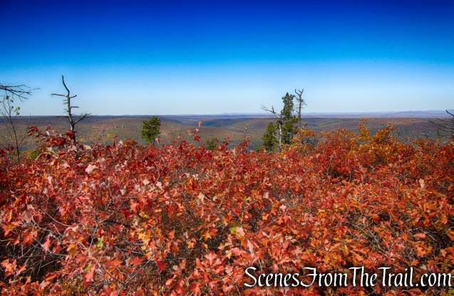
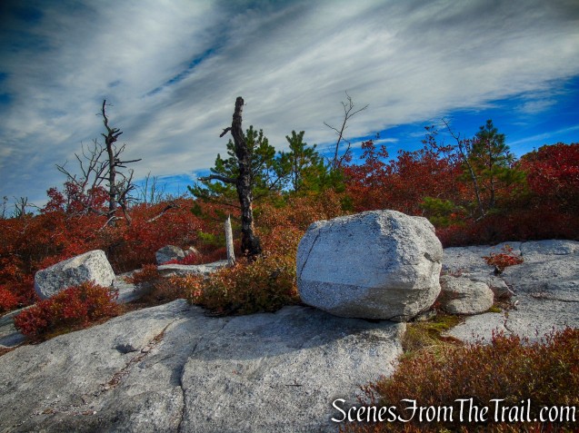
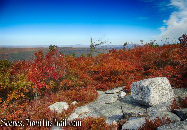
The trail begins a gradual climb to the high point on the ridge (1,791 feet). Just beyond, there is a panoramic north-facing view over Bear Hill. The trail now begins to descend over slabs of conglomerate rock dotted with pitch pines, with views of the Catskill Mountains to the northwest. As you approach the base of the descent, there are panoramic west-facing views.

Long Path/Shawangunk Ridge Trail – Shawangunk Ridge State Forest
Long Path/Shawangunk Ridge Trail – Shawangunk Ridge State Forest
Long Path/Shawangunk Ridge Trail – Shawangunk Ridge State Forest

Long Path/Shawangunk Ridge Trail – Shawangunk Ridge State Forest
Long Path/Shawangunk Ridge Trail – Shawangunk Ridge State Forest

Long Path/Shawangunk Ridge Trail – Shawangunk Ridge State Forest

Long Path/Shawangunk Ridge Trail – Shawangunk Ridge State Forest
Long Path/Shawangunk Ridge Trail – Shawangunk Ridge State Forest

Long Path/Shawangunk Ridge Trail – Shawangunk Ridge State Forest

Long Path/Shawangunk Ridge Trail – Shawangunk Ridge State Forest

Long Path/Shawangunk Ridge Trail – Shawangunk Ridge State Forest

Long Path/Shawangunk Ridge Trail – Shawangunk Ridge State Forest

Long Path/Shawangunk Ridge Trail – Shawangunk Ridge State Forest

Long Path/Shawangunk Ridge Trail – Shawangunk Ridge State Forest
After pausing to admire the spectacular views, follow the trail as it bears right and heads into the woods. In a short distance, you’ll come to a junction with the northern leg of the Red Trail. Turn right, leaving the Long Path/Shawangunk Ridge Trail, and begin once again to follow the red blazes.

Turn right on Red Trail
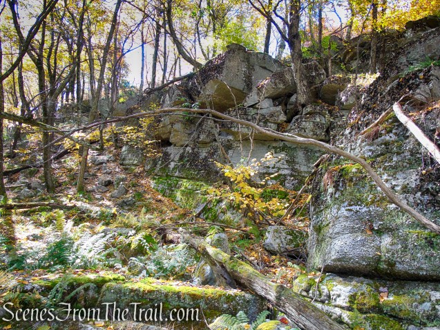
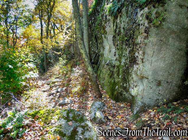
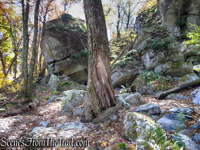
You’ll soon emerge into an area with dramatic cliffs and overhanging rocks on the right. You’re now directly paralleling the route you followed along the open slabs of conglomerate rock, but you’re following the cliffs that support these open rock slabs. Towards the end of this section, the trail has been routed through a narrow passage, with cliffs on one side and huge boulders on the other.

Red Trail – Shawangunk Ridge State Forest
Red Trail – Shawangunk Ridge State Forest

Red Trail – Shawangunk Ridge State Forest

Red Trail – Shawangunk Ridge State Forest

Red Trail – Shawangunk Ridge State Forest

Red Trail – Shawangunk Ridge State Forest
Red Trail – Shawangunk Ridge State Forest

Red Trail – Shawangunk Ridge State Forest

Red Trail – Shawangunk Ridge State Forest

Red Trail – Shawangunk Ridge State Forest

Red Trail – Shawangunk Ridge State Forest

Red Trail – Shawangunk Ridge State Forest
Red Trail – Shawangunk Ridge State Forest

Red Trail – Shawangunk Ridge State Forest
Red Trail – Shawangunk Ridge State Forest

Red Trail – Shawangunk Ridge State Forest

Red Trail – Shawangunk Ridge State Forest

Red Trail – Shawangunk Ridge State Forest

Red Trail – Shawangunk Ridge State Forest

Red Trail – Shawangunk Ridge State Forest

Red Trail – Shawangunk Ridge State Forest

Red Trail – Shawangunk Ridge State Forest
At the end of this spectacular section, the trail turns left and begins to descend. It soon joins a woods road, which it follows all the way back to a junction with the other branch of the Red Trail. Turn left at this junction and continue for a short distance to the parking area where the hike began.

Red Trail – Shawangunk Ridge State Forest
Red Trail – Shawangunk Ridge State Forest

Red Trail – Shawangunk Ridge State Forest

Red Trail – Shawangunk Ridge State Forest

Red Trail – Shawangunk Ridge State Forest

Red Trail – Shawangunk Ridge State Forest
Review:
I would highly recommend this hike to all. It covers an extremely scenic area with fantastic views and massive rock formations. The trails are well marked and easy to follow. The lower areas on the Red Trail have good tree cover, but the ridge is mostly exposed. This hike is best done during the Fall foliage season for the array of colors on display, but I’m sure that it is beautiful in any season. I recommend doing the loop clockwise so the views are in front of you as you descend the ridge as opposed to them being at your back as you ascend. This appears to be a popular hiking spot so either get there early or try visiting on a weekday.
Pros:
Fantastic views along the ridge, interesting rock formations, well marked trails, scenic landscape.
Cons:
Attracts crowds, Red Trail can be a little swampy after rainfall.
Take a hike!

Shawangunk Ridge State Forest Loop from Cox Road Trailhead
Sources: